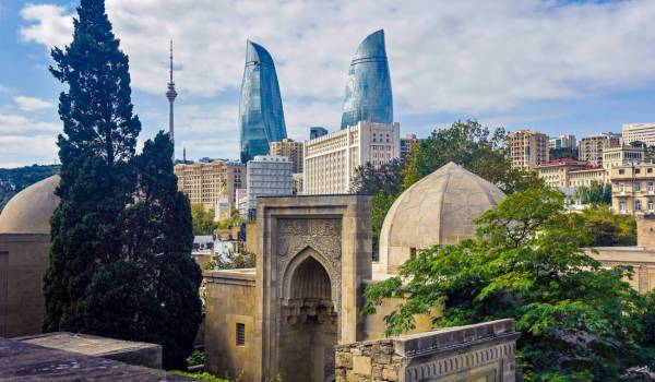
Baku
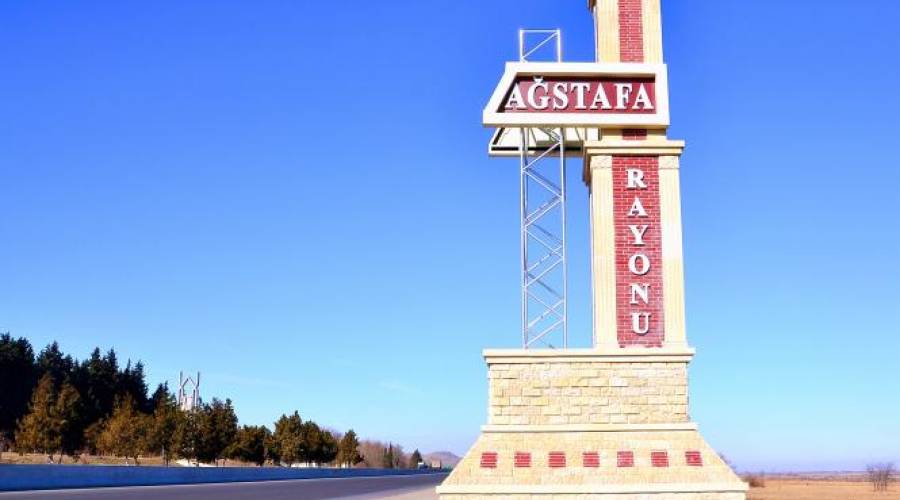
Agstafa is one of the largest western regions of Azerbaijan with beautiful nature. The largest river in Azerbaijan, the Kura, flows through this region. There are many historical monuments in the region. The ancient settlements of Toyratapa and Chobandashli are proof of this.
Agstafa is located in the northwestern part of the Republic of Azerbaijan, between the mountains of the Greater and Lesser Caucasus. Due to its favorable natural-geographical position, it is one of the oldest human settlements not only in Azerbaijan but in the South Caucasus as a whole. The main part of the region is the Tugay forests. A number of plants and birds listed in the "Red Book" are protected in the Garayazi State Reserve, which covers an area of 9658 hectares. The climate is characterized by harsh winters and hot plateaus. Tugay forests of the region consist of several zones. The area of Garayazi State Nature Reserve is 9572 hectares. They are mainly Tugay forests.
There are many archeological and historical monuments in the region. Among them are the Bronze Age human settlement of Toyratapa in the village of [Ashagi Kasaman] and the settlement of Chobandashli in the village of Dag Kasaman of the late Bronze Age - early Iron Age. Such monuments can be found in other parts of the region. Near Kochasgar village there are Molla Nagy hill (Stone Age), Bronze and Iron Age monuments Durnatepe, Boyuktepe, Shish Guzeyi Piri and medieval monuments Haja Dag Piri, ancient settlements of Bronze and Iron Age Jantepe, Yastitpe near Agstafa. We should also mention Ashagi Kasaman, Tatli, Yukhari Goyjali, Hasansu villages
Architectural monuments are of special interest: a tower of the XVII century, mosques of the XIX century in the village of Girag Kasaman, mosques built in the XIX century in Kolkhalfali, Garahasan, Dag Kasaman, and other villages, etc.
At present, there are monuments of world importance in the territory of Ashagi Goyjali village, such as the Toyratapa settlement, an ancient settlement in Dag Kasaman village, and a cemetery (Shepherd's stone). There are many ancient mosques in the region. In addition, the Keshish Mountain Temple, built as a Caucasian Albanian church, is located in Agstafa.
Medieval monuments preserved in the region include Tatli Alban Temple (early Middle Ages) - between Yukhari Goychali and Tatli villages, Hacha mountain building (medieval) - Kochasgar village, Residence (IV-VII centuries) - Dagkesemen village, Kahriz (XIX century) - Kolkhalafli village.
Keshikchidag State Historical and Cultural Reserve is a reserve in the cave complex covering part of the Keshikchidag range in the Agstafa region. It is located on the border of Agstafa with Georgia. This is a very interesting and unusual temple. The Keshikchidag cave-temple complex is located in the endless area called Jeyranchol, on the steep cliffs on the southern and south-eastern sides of the mountains at an altitude of 750-950 m above sea level.
Up to 100 artificial and natural caves were created in the territory of the reserve in the early and medieval times, ancient settlements inherited from our ancestors, about 100 Late Bronze and Early Iron Age mounds, a three-story fortress 11 meters high constructed on the high steep cliffs in the early Middle Ages by the local population of Caucasian Albania, 1500 meters apart two Albanian temples, facing south, The "Gudret" spring built of local stone materials and located in the Keshikchidag cave complex. The shrine reflects the ancient history, culture, and religious and ethnic characteristics of the locals.
By order of President Ilham Aliyev No. 2563 of December 19, 2007, a historical and cultural reserve was declared in the region with the aim of further studying, protecting, and popularizing the rich historical, ethnographic, and cultural monuments of the cave complex.
Discover more...
Baku
Gabala
Sheki
Nabran
Gakh
Guba