
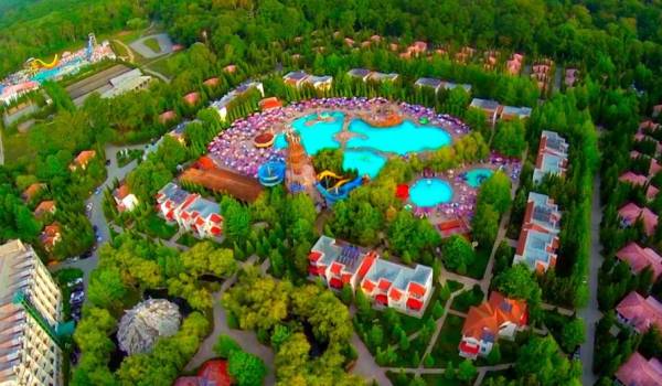
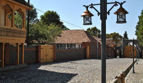
Yardimli Olimpiya Hotel
Hotel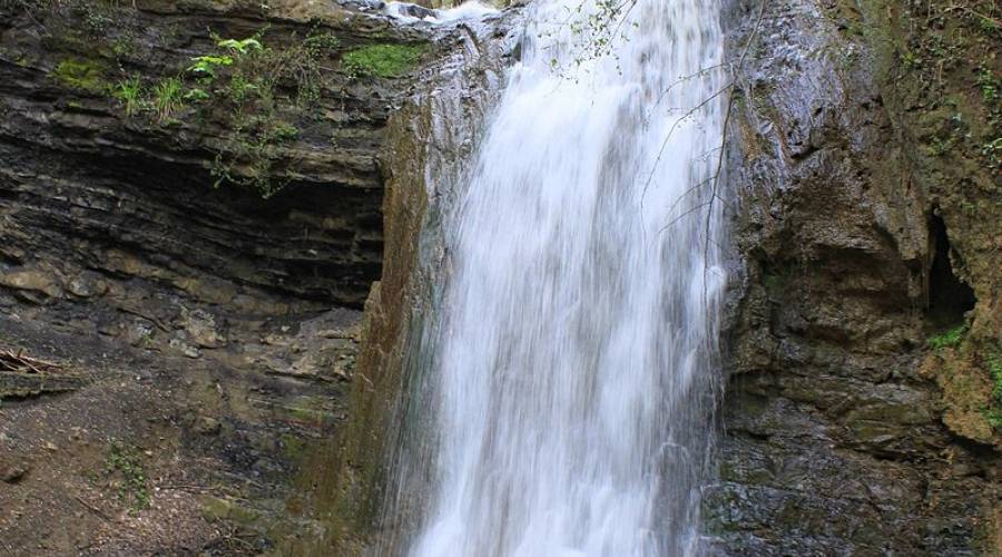
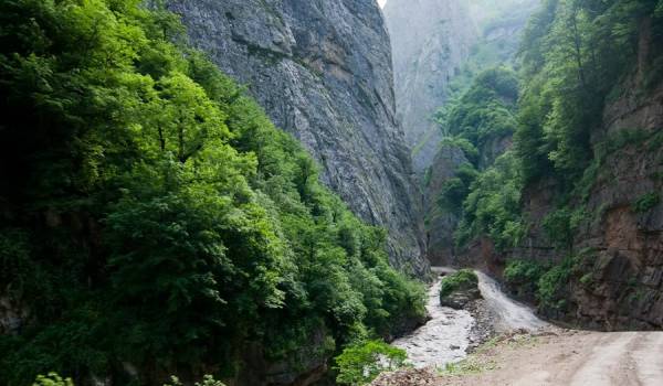
Yardimli region is located in the southeastern part of Azerbaijan, in a mountainous area. The flora and fauna of the region are unique and colorful in their own way. The lands of the Yardimli district are covered with dense green forests with numerous small rivers and springs flowing through them.
To go to Yardimli, you need to pass through the Masalli-Istisu area. It is 54 km from Masalli. The road leading here passes through the Deman plain. The historic Deman plain, which has a magnificent high mountain and forest landscape, is located at an altitude of 1600-1800 meters above sea level. This name is associated with the name of Teoma, the grandfather of the Hun Khan, general Mata.
The beautiful nature of these places, rivers, springs, and numerous historical monuments give Yardimli a special beauty. The region has rich fauna. Since the area of Yardimli was not exposed to glaciation, it is rich in relict and endemic tree species of the third period - azat ironwood, chestnut-leaved oak, and birgoz, razgin bushes.
Of course, one of the most visited places by these tourists is "Takdam waterfall". Takdam waterfall is located on the 25th km of Masalli-Yardimli road. The waterfall falling from a height of 34 meters, which is the business card of Yardimli, has two floors. There are high stairs to reach the top. From this point at an altitude of about 1500 meters, a magnificent panorama opens up. During Soviet rule, the only watchman's hut in this mountainous and forested area was built next to the waterfall, so it was called a "single roof".
Perimbel village is one of the natural areas preferred by tourists. This village attracts people because of its location in the forest on the slopes of the mountains. Also, the ancient spring of Gez Naran, which flows nearby, is also a popular tourist spot.
The waterfall and sour spring on Mount Peshtasar, and the second spring near the border with Gajar, at the height of Abdalli village, are ideal places for those who want to enjoy nature. These two places, characterized by a sharp temperature difference, are only known to the residents of the region and are visited during the hot summer months.
Yardimli district borders the Islamic Republic of Iran and the Lerik, Masalli, and Jalilabad districts of the Republic of Azerbaijan. Its border with Lerik district is 40 km from the south, 11 km from the east with Masalli district, and 20 km from the northeast with Jalilabad district. The length of the state border with the neighboring Islamic Republic of Iran to the north and west is 96 km.
The largest and longest river in the region is the Vilash river. It flows into the Caspian Sea. Its length is 111 km. The tributaries of the Vilash river are Allar, Peshtasar, Solgard, and Velishli rivers. The territory of the district is surrounded by the Talysh mountains and Buravar mountains.
Browse through our carefully curated collection of hotels, resorts, and accommodations tailored to each destination. Whether you're seeking luxury, relaxation, or a budget-friendly option, our accommodation section offers a diverse range of choices to suit every traveler's needs. From charming boutique hotels to sprawling resorts, find your perfect home away from home and make the most of your stay in each destination.
Yardimli Olimpiya Hotel
HotelDiscover more...
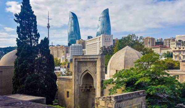
Baku
Gabala
Sheki
Nabran
Gakh
Guba